United Kingdom (United Kingdom of Great Britain and Northern Ireland), GB
United Kingdom: Country in Western Europe
About

Quick Facts about United Kingdom of Great Britain and Northern Ireland
| Population : | 66,022,273 |
| Country : | United Kingdom |
| Different from : | Great Britain, United Kingdom of Great Britain and Ireland, Category:United Kingdom |
| Head of government : | Prime Minister of the United Kingdom |
| Plate code : | GB |
| Area : | 242495.41 km2 |
| Official name : | Ir-Renju Unit tal-Gran Brittanja u l-Irlanda ta' Fuq, Spojené kráľovstvo Veľkej Británie a Severného Írska, Regatul Unit al Marii Britanii și al Irlandei de Nord, Regno Unito di Gran Bretagna e Irlanda del Nord, Об'єднане Королівство Великої Британії та Північної Ірландії, Teyrnas Unedig Prydain Fawr a Gogledd Iwerddon, Spojené království Velké Británie a Severního Irska, Förenade konungariket Storbritannien och Nordirland, Unitit Kinrick o Great Breetain an Northren Irland, Zjednoćene kralestwo Wulkeje Britaniskeje a Sewjerneje Irskeje, Royaume-Uni de Grande-Bretagne et d'Irlande du Nord, le Royaume-Uni de Grande-Bretagne et d’Irlande du Nord, Ηνωμένο Βασίλειο της Μεγάλης Βρετανίας και της Βόρειας Ιρλανδίας, Соединённое королевство Великобритании и Северной Ирландии, Vereinigtes Königreich Großbritannien und Nordirland, Nagy-Britannia és Észak-Írország Egyesült Királysága, Regne Unit, United Kingdom of Great Britain and Northern Ireland |
| Continent : | Europe |
| Easternmost point : | Point(1.76297307 52.48106832) |
| Northernmost point : | Point(-0.87 60.87) |
| Legislative body : | Parliament of the United Kingdom |
| Official language : | English, Welsh |
| Capital : | London |
| Establishment : | April 04, 1927 (98 years ago) |
| Time Zone : | Greenwich Mean Time, Western European Time, UTC±00:00, UTC−04:00, UTC+06:00, UTC−08:00, UTC+02:00, UTC−05:00, UTC+01:00, UTC−04:00, UTC−02:00, UTC±00:00, UTC+02:00, UTC−03:00, UTC+01:00 |
| Local time : | 06:30:19 (1st July 2025) |


Geography
United Kingdom of Great Britain and Northern Ireland is located at 54°0'0"N 4°0'0"W (54.0, -4.0). It has 17 neighbors: Cyprus, Maldives, Spain, Denmark, Belgium, Germany, Ireland, France, Norway, Jamaica, Cuba, Bahamas, Saint Kitts and Nevis, Antigua and Barbuda, Venezuela, Argentina and Union.
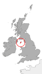
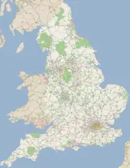
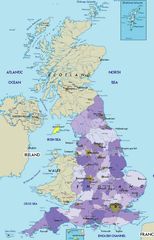
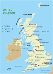
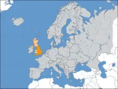
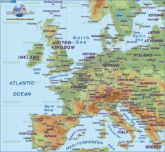
United Kingdom map
The largest city of United Kingdom of Great Britain and Northern Ireland is London with a population of 8,908,081. Other cities include, Birmingham population 1,137,100, Sheffield population 685,368, Glasgow population 626,410 and Bristol population 567,111. See all United Kingdom of Great Britain and Northern Ireland cities & populated places.
- Boris Johnson , 2019-07-24T00:00:00Z
- Theresa May , 24 July, 2019 2016-07-13T00:00:00Z
- David Cameron , 12 July, 2016 2010-05-11T00:00:00Z
United Kingdom of Great Britain and Northern Ireland has 17 neighbours.
- Republic of Cyprus Independent country situated on an island in the Eastern Mediterranean Sea
- Republic of Maldives Independent country in South Asia, situated on an archipelago in the Arabian Sea
- Kingdom of Spain Independent country in southwestern Europe with territories in the Mediterranean Sea, the Atlantic Ocean and northern Africa
- Kingdom of Denmark Independent country in northern Europe that is part of the Kingdom of Denmark
- Kingdom of Belgium Independent country in western Europe
- Federal Republic of Germany Independent country in Central Europe
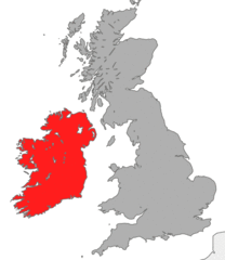
- Ireland Independent country in northwestern Europe covering five-sixths of the island of Ireland
- Republic of France Independent country with mainland in Western Europe and several overseas territories
- Kingdom of Norway Independent country in northern Europe
- Jamaica island sovereign state in the Caribbean Sea
- Republic of Cuba Independent country situated on an island in the Caribbean Sea
- Commonwealth of The Bahamas island sovereign state in the West Indies
- Federation of Saint Kitts and Nevis island sovereign state in the Caribbean Sea
- Antigua and Barbuda island sovereign state in the Caribbean Sea
- Bolivarian Republic of Venezuela Independent country in northern South America
- Argentine Republic Independent country in South America
- Union A city in Union County, New Jersey. It is located in the northeastern part of the county. Union is known for its many parks and green spaces, its many historical sites, and its many attractions, such as the Kean University campus and the Union City Historical Society.
- Southern Ireland
- Scotland
- England
- Wales
- Northern Ireland
Demographics
| Year | Population | % Change | Method |
| 1960 | 52,400,000 | - | |
| 1961 | 52,800,000 | 0.76% | estimation process |
| 1962 | 53,250,000 | 0.85% | estimation process |
| 1963 | 53,650,000 | 0.75% | estimation process |
| 1964 | 54,000,000 | 0.65% | |
| 1965 | 54,348,050 | 0.64% | census |
| 1966 | 54,648,500 | 0.55% | |
| 1967 | 54,943,600 | 0.54% | census |
| 1968 | 55,211,700 | 0.49% | census |
| 1969 | 55,441,750 | 0.41% | estimation process |
| 1970 | 55,663,250 | 0.4% | census |
| 1971 | 55,896,223 | 0.42% | census |
| 1972 | 56,086,065 | 0.34% | census |
| 1973 | 56,194,527 | 0.19% | estimation process |
| 1974 | 56,229,974 | 0.06% | estimation process |
| 1975 | 56,225,800 | -0.01% | estimation process |
| 1976 | 56,211,968 | -0.02% | census |
| 1977 | 56,193,492 | -0.03% | |
| 1978 | 56,196,504 | 0.01% | census |
| 1979 | 56,246,951 | 0.09% | census |
| 1980 | 56,314,216 | 0.12% | census |
| 1981 | 56,333,829 | 0.03% | census |
| 1982 | 56,313,641 | -0.04% | census |
| 1983 | 56,332,848 | 0.03% | |
| 1984 | 56,422,072 | 0.16% | census |
| 1985 | 56,550,268 | 0.23% | |
| 1986 | 56,681,396 | 0.23% | estimation process |
| 1987 | 56,802,050 | 0.21% | |
| 1988 | 56,928,327 | 0.22% | |
| 1989 | 57,076,711 | 0.26% | estimation process |
| 1990 | 57,247,586 | 0.3% | census |
| 1991 | 57,424,897 | 0.31% | census |
| 1992 | 57,580,402 | 0.27% | census |
| 1993 | 57,718,614 | 0.24% | estimation process |
| 1994 | 57,865,745 | 0.25% | census |
| 1995 | 58,019,030 | 0.26% | estimation process |
| 1996 | 58,166,950 | 0.25% | estimation process |
| 1997 | 58,316,954 | 0.26% | |
| 1998 | 58,487,141 | 0.29% | estimation process |
| 1999 | 58,682,466 | 0.33% | estimation process |
| 2000 | 58,892,514 | 0.36% | census |
| 2001 | 59,119,673 | 0.38% | estimation process |
| 2002 | 59,370,479 | 0.42% | census |
| 2003 | 59,647,577 | 0.46% | estimation process |
| 2004 | 59,987,905 | 0.57% | census |
| 2005 | 60,401,206 | 0.68% | census |
| 2006 | 60,846,820 | 0.73% | census |
| 2007 | 61,322,463 | 0.78% | estimation process |
| 2008 | 61,806,995 | 0.78% | estimation process |
| 2009 | 62,276,270 | 0.75% | estimation process |
| 2010 | 62,766,365 | 0.78% | census |
| 2011 | 63,258,918 | 0.78% | |
| 2012 | 63,700,300 | 0.69% | census |
| 2013 | 64,106,779 | 0.63% | |
| 2014 | 64,602,298 | 0.77% | (Worldbank) |
| 2015 | 65,116,219 | 0.79% | (Worldbank) |
| 2016 | 65,102,385 | -0.02% | estimation process |
| 2017 | 66,022,273 | 1.39% | estimation process |
| 2018 | 66,460,344 | 0.66% | (Worldbank) |
| 2019 | 66,834,405 | 0.56% | (Worldbank) |
