Uganda (Republic of Uganda), UG
Uganda: Independent country in East Africa
About

Quick Facts about Republic of Uganda
| Population : | 42,862,958 |
| Country : | Uganda |
| Head of government : | Prime Minister of Uganda |
| Plate code : | EAU |
| Area : | 241038 km2 |
| Official name : | Ouganda, Uganda, Uganda |
| Water as percent of area : | 18.2% |
| Land as percent of area : | 81.8% |
| Continent : | Africa |
| Northernmost point : | Point(34.0 4.22) |
| Legislative body : | Parliament of Uganda |
| Official language : | English, Swahili |
| Capital : | Kampala |
| Establishment : | January 01, 1962 (63 years ago) |
| Time Zone : | UTC+03:00 |
| Local time : | 06:45:31 (1st July 2025) |


Geography
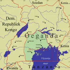
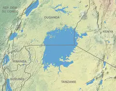
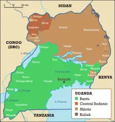
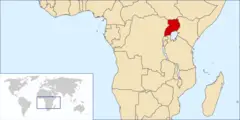
Republic of Uganda is located at 1°15'0"N 32°30'0"E (1.2500000, 32.5000000). It has 6 neighbors: Rwanda, Tanzania, Kenya, Congo Kinshasa, Sudan and South Sudan.
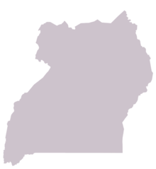
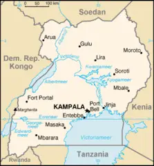
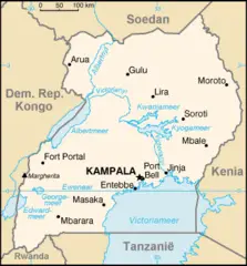
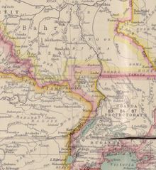
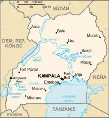
Uganda map
The largest city of Republic of Uganda is Kampala with a population of 1,353,189. Other cities include, Gulu population 146,858, Bwizibwera population 79,157, Mbale population 76,493 and Entebbe population 62,969. See all Republic of Uganda cities & populated places.
- Official Website
Official website of Republic of Uganda
Ruhakana Rugunda ,
Republic of Uganda has 6 neighbours.
- Republic of Rwanda Independent country in Africa
- United Republic of Tanzania Independent country in Africa
- Republic of Kenya Independent country in East Africa
- Democratic Republic of the Congo Independent country in Central Africa
- Republic of the Sudan Independent country in Northeast Africa
- South Sudan Independent country in Africa
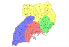
- Kitagwenda District
- Rwampara district
- Kazo District
- Kalaki District
- Obongi District
- Madi-Okollo District
- Karenga District
- Nabilatuk District
- Kwania District
- Pakwach District
- Omoro District
- Kapelebyong District
- Bugweri District
- Namisindwa District
- Butebo District
- Kasanda District
- Kyotera District
- Kibuube District
- Rukiga District
- Bunyangabu District
- Rubanda District
- Kakumiro District
- Kagadi District
- Dokolo District
- Lwengo District
- Gomba District
- Nakaseke District
- Bulambuli District
- Katakwi District
- Serere District
- Moyo District
- Kiruhura District
- Mpigi District
- Amuria District
- Jinja District
- Kalangala District
- Sironko District
- Bukomansimbi District
- Isingiro District
- Koboko District
- Lamwo District
- Luwero District
- Soroti District
- Busia District
- Luuka District
- Kabarole District
- Mayuge District
- Nakasongola District
- Zombo District
- Kaabong District
- Kyankwanzi District
- Kumi District
- Namayingo District
- Iganga District
- Kayunga District
- Sheema District
- Mityana District
- Pader District
- Kaliro District
- Apac District
- Kole District
- Kisoro District
- Bundibugyo District
- Gulu District
- Arua District
- Buliisa District
- Ntungamo District
- Buvuma District
- Kamwenge District
- Kapchorwa District
- Bukwo District
- Alebtong District
- Mitooma District
- Moroto District
- Buikwe District
- Masaka District
- Kibuku District
- Mbale District
- Kasese District
- Kalungu District
- Maracha District
- Manafwa District
- Nwoya District
- Namutumba District
- Agago District
- Kiboga District
- Sembabule District
- Ibanda District
- Lira District
- Kanungu District
- Rukungiri District
- Amudat District
- Kibaale District
- Buhweju District
- Napak District
- Ngora District
- Kitgum District
- Nebbi District
- Kiryandongo District
- Kamuli District
- Kotido District
- Masindi District
- Buyende District
- Kabale District
- Mbarara District
- Amuru District
- Tororo District
- Yumbe District
- Hoima District
- Budaka District
- Kyenjojo District
- Kaberamaido District
- Pallisa District
- Amolatar District
- Bukedea District
- Wakiso District
- Butambala District
- Kyegegwa District
- Rubirizi District
- Ntoroko District
- Abim District
- Mubende District
- Otuke District
- Lyantonde District
- Bududa District
- Kween District
- Butaleja District
- Kampala District
- Bushenyi District
- Mukono District
- Rakai District
- Nakapiripirit District
- Oyam District
- Adjumani District
- Bugiri District
Demographics
| Year | Population | % Change | Method |
| 1960 | 6,788,211 | - | 2017-01-01T00:00:00Z |
| 1961 | 7,006,629 | 3.12% | 2017-01-01T00:00:00Z |
| 1962 | 7,240,155 | 3.23% | 2017-01-01T00:00:00Z |
| 1963 | 7,487,412 | 3.3% | 2017-01-01T00:00:00Z |
| 1964 | 7,746,181 | 3.34% | 2017-01-01T00:00:00Z |
| 1965 | 8,014,376 | 3.35% | 2017-01-01T00:00:00Z |
| 1966 | 8,292,751 | 3.36% | 2017-01-01T00:00:00Z |
| 1967 | 8,580,647 | 3.36% | 2017-01-01T00:00:00Z |
| 1968 | 8,872,890 | 3.29% | 2017-01-01T00:00:00Z |
| 1969 | 9,162,794 | 3.16% | 2017-01-01T00:00:00Z |
| 1970 | 9,446,024 | 3% | 2017-01-01T00:00:00Z |
| 1971 | 9,720,388 | 2.82% | 2017-01-01T00:00:00Z |
| 1972 | 9,988,441 | 2.68% | 2017-01-01T00:00:00Z |
| 1973 | 10,256,553 | 2.61% | 2017-01-01T00:00:00Z |
| 1974 | 10,533,820 | 2.63% | 2017-01-01T00:00:00Z |
| 1975 | 10,827,097 | 2.71% | 2017-01-01T00:00:00Z |
| 1976 | 11,139,632 | 2.81% | 2017-01-01T00:00:00Z |
| 1977 | 11,470,628 | 2.89% | 2017-01-01T00:00:00Z |
| 1978 | 11,818,135 | 2.94% | 2017-01-01T00:00:00Z |
| 1979 | 12,178,512 | 2.96% | 2017-01-01T00:00:00Z |
| 1980 | 12,549,779 | 2.96% | 2017-01-01T00:00:00Z |
| 1981 | 12,930,714 | 2.95% | 2017-01-01T00:00:00Z |
| 1982 | 13,324,390 | 2.95% | 2017-01-01T00:00:00Z |
| 1983 | 13,738,114 | 3.01% | 2017-01-01T00:00:00Z |
| 1984 | 14,181,630 | 3.13% | 2017-01-01T00:00:00Z |
| 1985 | 14,661,481 | 3.27% | 2017-01-01T00:00:00Z |
| 1986 | 15,180,721 | 3.42% | 2017-01-01T00:00:00Z |
| 1987 | 15,736,176 | 3.53% | 2017-01-01T00:00:00Z |
| 1988 | 16,320,417 | 3.58% | 2017-01-01T00:00:00Z |
| 1989 | 16,922,648 | 3.56% | 2017-01-01T00:00:00Z |
| 1990 | 17,534,839 | 3.49% | 2017-01-01T00:00:00Z |
| 1991 | 18,156,095 | 3.42% | 2017-01-01T00:00:00Z |
| 1992 | 18,788,440 | 3.37% | 2017-01-01T00:00:00Z |
| 1993 | 19,430,461 | 3.3% | 2017-01-01T00:00:00Z |
| 1994 | 20,081,152 | 3.24% | 2017-01-01T00:00:00Z |
| 1995 | 20,740,726 | 3.18% | 2017-01-01T00:00:00Z |
| 1996 | 21,407,693 | 3.12% | 2017-01-01T00:00:00Z |
| 1997 | 22,084,527 | 3.06% | 2017-01-01T00:00:00Z |
| 1998 | 22,780,451 | 3.05% | 2017-01-01T00:00:00Z |
| 1999 | 23,507,800 | 3.09% | 2017-01-01T00:00:00Z |
| 2000 | 24,275,641 | 3.16% | 2017-01-01T00:00:00Z |
| 2001 | 25,088,033 | 3.24% | 2017-01-01T00:00:00Z |
| 2002 | 25,943,441 | 3.3% | 2017-01-01T00:00:00Z |
| 2003 | 26,838,428 | 3.33% | 2017-01-01T00:00:00Z |
| 2004 | 27,766,986 | 3.34% | 2017-01-01T00:00:00Z |
| 2005 | 28,724,869 | 3.33% | 2017-01-01T00:00:00Z |
| 2006 | 29,711,397 | 3.32% | 2017-01-01T00:00:00Z |
| 2007 | 30,728,747 | 3.31% | 2017-01-01T00:00:00Z |
| 2008 | 31,778,799 | 3.3% | 2017-01-01T00:00:00Z |
| 2009 | 32,864,328 | 3.3% | 2017-01-01T00:00:00Z |
| 2010 | 33,987,213 | 3.3% | 2017-01-01T00:00:00Z |
| 2011 | 35,148,064 | 3.3% | 2017-01-01T00:00:00Z |
| 2012 | 36,345,860 | 3.3% | 2017-01-01T00:00:00Z |
| 2013 | 37,578,876 | 3.28% | 2017-01-01T00:00:00Z |
| 2014 | 34,634,650 | -8.5% | 2017-01-01T00:00:00Z |
| 2015 | 38,225,453 | 9.39% | (Worldbank) |
| 2016 | 39,647,506 | 3.59% | (Worldbank) |
| 2017 | 42,862,958 | 7.5% | 2017-01-01T00:00:00Z |
| 2018 | 42,723,139 | -0.33% | (Worldbank) |
| 2019 | 44,269,594 | 3.49% | (Worldbank) |
