Serbia, RS
Serbia: Independent country in southeastern Europe
About
Quick Facts about Serbia
| Population : | 7,022,268 |
| Country : | Serbia |
| Different from : | Republika Srpska |
| Head of government : | Prime Minister of Serbia |
| Plate code : | SRB |
| Area : | 88361 km2 |
| Official name : | la République de Serbie, Србија |
| Continent : | Europe |
| Easternmost point : | Point(23.00629511 43.18729985) |
| Northernmost point : | Point(19.67 46.18) |
| Legislative body : | National Assembly of Serbia |
| Official language : | Serbian |
| Capital : | Belgrade |
| Establishment : | January 01, 1970 (19 years ago) |
| Time Zone : | Europe/Belgrade, Central European Time, UTC+02:00, UTC+01:00 |
| Local time : | 07:07:42 (1st July 2025) |
Geography
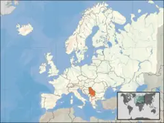
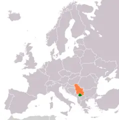
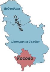
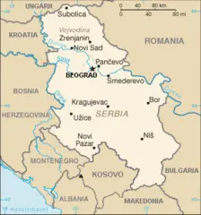
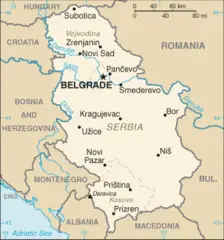
Serbia is located at 44°49'8"N 20°27'36"E (44.818924690689, 20.4599761962891). It has 10 neighbors: North Macedonia, Bulgaria, Albania, Romania, Hun, Croatia, Bosnia and Herzegovina, Montenegro, Union and Kosovo.
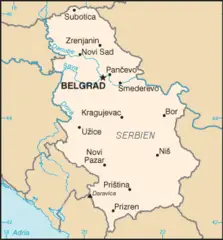
Serbia map
The largest city of Serbia is Belgrade with a population of 1,378,682. Other cities include, Pristina population 550,000, Novi Pazar population 85,996, Kruševac population 75,256 and Suva Reka population 72,229. See all Serbia cities & populated places.
- Official Website
Official website of Serbia
Ana Brnabić ,
Serbia has 10 neighbours.
- Република Македонија Independent country in southeastern Europe
- Republic of Bulgaria Independent country in southeastern Europe
- Republic of Albania Independent country in Southeast Europe
- România Independent country in southeastern Europe
- Hūn Independent country in Central Europe
- Republic of Croatia Independent country in Central Europe
- Bosnia and Herzegovina Independent country in southeastern Europe
- Montenegro Independent country in southeastern Europe
- Union A city in Union County, New Jersey. It is located in the northeastern part of the county. Union is known for its many parks and green spaces, its many historical sites, and its many attractions, such as the Kean University campus and the Union City Historical Society.
- Kosovo country in Europe with partially recognized sovereignty
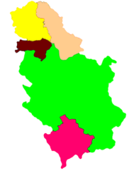
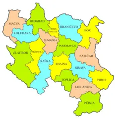
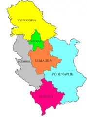
- West Bačka District
- Podunavlje District
- Central Banat District
- Mačva District
- Peć District
- Zaječar District
- Kosovska Mitrovica District
- Prizren District
- Kolubara District
- Kosovo-Pomoravlje District
- Srem District
- Braničevo District
- South Bačka District
- Toplica District
- Rasina District
- North Bačka District
- Bor District
- Zlatibor District
- Belgrade District
- Kosovo District
- Pirot District
- Pomoravlje District
- Pčinja District
- North Banat District
- Raška District
- Moravica District
- Nišava District
- Jablanica District
- Šumadija District
- South Banat District
Demographics
| Year | Population | % Change | Method |
| 1990 | 7,586,000 | - | (Worldbank) |
| 1991 | 7,595,636 | 0.13% | (Worldbank) |
| 1992 | 7,646,424 | 0.66% | (Worldbank) |
| 1993 | 7,699,307 | 0.69% | (Worldbank) |
| 1994 | 7,734,639 | 0.46% | (Worldbank) |
| 1995 | 7,625,357 | -1.43% | (Worldbank) |
| 1996 | 7,617,794 | -0.1% | (Worldbank) |
| 1997 | 7,596,501 | -0.28% | (Worldbank) |
| 1998 | 7,567,745 | -0.38% | (Worldbank) |
| 1999 | 7,540,401 | -0.36% | (Worldbank) |
| 2000 | 7,516,346 | -0.32% | (Worldbank) |
| 2001 | 7,503,433 | -0.17% | (Worldbank) |
| 2002 | 7,496,522 | -0.09% | (Worldbank) |
| 2003 | 7,480,591 | -0.21% | (Worldbank) |
| 2004 | 7,463,157 | -0.23% | (Worldbank) |
| 2005 | 7,440,769 | -0.3% | (Worldbank) |
| 2006 | 7,411,569 | -0.39% | (Worldbank) |
| 2007 | 7,381,579 | -0.41% | (Worldbank) |
| 2008 | 7,350,222 | -0.43% | (Worldbank) |
| 2009 | 7,320,807 | -0.4% | (Worldbank) |
| 2010 | 7,291,436 | -0.4% | (Worldbank) |
| 2011 | 7,234,099 | -0.79% | (Worldbank) |
| 2012 | 7,199,077 | -0.49% | (Worldbank) |
| 2013 | 7,164,132 | -0.49% | (Worldbank) |
| 2014 | 7,130,576 | -0.47% | (Worldbank) |
| 2015 | 7,095,383 | -0.5% | (Worldbank) |
| 2016 | 7,041,599 | -0.76% | estimation process |
| 2017 | 7,022,268 | -0.28% | estimation process |
| 2018 | 6,982,604 | -0.57% | (Worldbank) |
| 2019 | 6,944,975 | -0.54% | (Worldbank) |
.png)
