Mexico, MX
Mexico: Independent country in the southern portion of North America
About

Quick Facts about Mexico
| Population : | 130,526,945 |
| Country : | Mexico |
| Head of government : | President of Mexico |
| Twitter username : | mexico |
| Plate code : | MEX |
| Area : | 1972550 km2 |
| Official name : | Unuiĝintaj Ŝtatoj de Meksiko, الولايات المكسيكية المتحدة, Estaos Xuníos Mexicanos, Մեքսիկայի Միացյալ Նահանգներ, États-Unis mexicains, Estados Unidos Mexicanos, Estats Units Mexicans, Estados Unidos Mexicanos, Unol Daleithiau Mecsico, Vereinigte Mexikanische Staaten, les États unis mexicains |
| Continent : | North America |
| Easternmost point : | Point(-86.74072981 21.135385) |
| Northernmost point : | Point(-114.719722222 32.718888888) |
| Legislative body : | Congress of the Union |
| Official language : | Spanish, Nahuatl, Yucatec Maya, languages of Mexico |
| Capital : | Mexico City |
| Establishment : | January 01, 1970 (188 years ago) |
| Time Zone : | Central Time Zone, Pacific Time Zone, Mountain Time Zone, Eastern Time Zone |
| Local time : | 13:16:01 (25th May 2025) |


Geography
Mexico is located at 23°0'0"N 102°0'0"W (23.0, -102.0). It has 3 neighbors: Belize, Guatemala and United States.
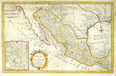
Mexico map
The largest city of Mexico is Mexico City with a population of 8,918,653. Other cities include, Ecatepec de Morelos population 1,655,015, Guadalajara population 1,495,182, Ciudad Juárez population 1,321,004 and Ciudad Nezahualcoyotl population 1,104,585. See all Mexico cities & populated places.
- Go to Official Website
- Go to Official Website
- Go to Official Website
Official website of Mexico
- Enrique Peña Nieto , 1 December, 2018 2012-12-01T00:00:00Z
- Felipe Calderón , 1 December, 2012 2006-12-01T00:00:00Z
- Andrés Manuel López Obrador , 2018-12-01T00:00:00Z
Mexico has 3 neighbours.
- Belize Independent country in Central America
- Republic of Guatemala Independent country in Central America
- United States Independent country in North America
- Sonora
- Nuevo León
- Morelos
- Tabasco
- Querétaro
- Michoacán
- Guanajuato
- State of Mexico
- Mexico City
- Chihuahua
- Jalisco
- Chiapas
- Oaxaca
- Durango
- Campeche
- San Luis Potosí
- Yucatán
- Veracruz
- Aguascalientes
- Coahuila
- Guerrero
- Colima
- Baja California Sur
- Tamaulipas
- Tlaxcala
- Baja California
- Hidalgo
- Zacatecas
- Nayarit
- Sinaloa
- Puebla
- Quintana Roo
Demographics
| Year | Population | % Change | Method |
| 1960 | 38,676,974 | - | census |
| 1961 | 39,939,271 | 3.16% | census |
| 1962 | 41,234,350 | 3.14% | census |
| 1963 | 42,564,038 | 3.12% | census |
| 1964 | 43,931,398 | 3.11% | census |
| 1965 | 45,338,827 | 3.1% | census |
| 1966 | 46,783,542 | 3.09% | census |
| 1967 | 48,264,496 | 3.07% | census |
| 1968 | 49,787,609 | 3.06% | census |
| 1969 | 51,360,846 | 3.06% | census |
| 1970 | 52,988,138 | 3.07% | census |
| 1971 | 54,669,034 | 3.07% | census |
| 1972 | 56,395,803 | 3.06% | census |
| 1973 | 58,155,590 | 3.03% | census |
| 1974 | 59,931,341 | 2.96% | census |
| 1975 | 61,708,369 | 2.88% | census |
| 1976 | 63,486,196 | 2.8% | census |
| 1977 | 65,261,295 | 2.72% | census |
| 1978 | 67,012,869 | 2.61% | census |
| 1979 | 68,715,443 | 2.48% | census |
| 1980 | 70,353,013 | 2.33% | census |
| 1981 | 71,916,281 | 2.17% | census |
| 1982 | 73,415,735 | 2.04% | census |
| 1983 | 74,880,326 | 1.96% | census |
| 1984 | 76,351,106 | 1.93% | census |
| 1985 | 77,859,344 | 1.94% | census |
| 1986 | 79,410,218 | 1.95% | census |
| 1987 | 80,999,175 | 1.96% | census |
| 1988 | 82,635,332 | 1.98% | census |
| 1989 | 84,326,921 | 2.01% | census |
| 1990 | 86,077,004 | 2.03% | census |
| 1991 | 87,890,094 | 2.06% | census |
| 1992 | 89,757,916 | 2.08% | census |
| 1993 | 91,653,826 | 2.07% | census |
| 1994 | 93,541,577 | 2.02% | census |
| 1995 | 95,392,647 | 1.94% | census |
| 1996 | 97,201,533 | 1.86% | census |
| 1997 | 98,968,558 | 1.79% | census |
| 1998 | 100,678,867 | 1.7% | census |
| 1999 | 102,316,781 | 1.6% | census |
| 2000 | 103,873,607 | 1.5% | census |
| 2001 | 105,339,877 | 1.39% | census |
| 2002 | 106,723,661 | 1.3% | census |
| 2003 | 108,056,312 | 1.23% | census |
| 2004 | 109,381,550 | 1.21% | census |
| 2005 | 110,731,826 | 1.22% | census |
| 2006 | 112,116,694 | 1.24% | census |
| 2007 | 113,529,819 | 1.24% | census |
| 2008 | 114,968,039 | 1.25% | census |
| 2009 | 116,422,752 | 1.25% | census |
| 2010 | 112,336,538 | -3.64% | census |
| 2011 | 119,361,233 | 5.89% | census |
| 2012 | 120,847,449 | 1.23% | census |
| 2013 | 122,332,399 | 1.21% | census |
| 2014 | 120,355,128 | -1.64% | (Worldbank) |
| 2015 | 121,858,258 | 1.23% | (Worldbank) |
| 2016 | 123,333,376 | 1.2% | (Worldbank) |
| 2017 | 130,526,945 | 5.51% | census |
| 2018 | 126,190,788 | -3.44% | (Worldbank) |
| 2019 | 127,575,529 | 1.09% | (Worldbank) |
Estados Unidos Mexicanos, Maexikaen, Maxiko, Me-hi-co, Mec'hiko, Mecsico, Mehhiko, Mehika, Mehiko, Mehksyka, Meicsiceo, Mejico, Mekesiko, Mekesikō, Mekiko, Meksik, Meksika, Meksike, Meksiko, Meksikë, Meksyk, Meksîk, Meksіka, Mesico, Messich, Messico, Messicu, Messiku, Mexic, Mexican Republic, Mexico, Mexicum, Mexihco, Mexikia, Mexiko, Mexikó, Mexique, Mexíkó, Mishiku, Mäxikän, Mèsico, Mèssico, Mèssicu, Mèxic, Méjico, Méssich, México, Mê-hi-cô, Mēxihco, Mễ Tay Cơ (Me-hi-co), Mễ Tây Cơ (Mê-hi-cô), Nueva Espana, Nueva España, Republica Mejicana, Republica Mejico, Republica Mexicana, República Mejicana, República Méjico, United Mexican States, el pais azteca, el país azteca, mexygu'e, Μεξικό, Мексика, Мексико, Мексіка, Мэксыка, Մեքսիկա, מעקסיקע, מקסיקו, المكسيك, مکزیک, میکسیکو, مېكسىكا, मेक्सिको, মক্সিকো, মেক্সিকো, மெக்சிகோ, മെക്സിക്കോ, മേക്സിക്കോ, ประเทศเม็กซิโก, เม็กซิโก, ແມັກຊິໂກ, མེཀ་སི་ཀོ།, མེཀསི་ཀོ, მექსიკა, ሜክሲኮ, ម៉ិចសិក, メキシコ, メキシコ合衆国, 墨西哥, 멕시코
Other places with the same name (3)
- Mexico , Missouri city in and county seat of Audrain County, Missouri with a population of 11,530 people.
- Mexico , New York town in Oswego County, New York with a population of 5,043 people.
- Mexico , Maine town in Maine with a population of 2,635 people.

